Top BIM and Drafting Software Used in Major Airport and Rail Projects
in the USA and Canada
This blog explores the top BIM and drafting software used in major airport and rail projects across the USA and Canada. It explains how tools like Autodesk Revit, Civil 3D, Navisworks, and Bentley OpenRail Designer help engineers design, coordinate, and manage complex transportation infrastructure more efficiently than traditional CAD methods.
Through real-world examples from projects like LAX, O’Hare, Denver Rail, and Toronto Pearson Airport, it shows how BIM improves clash detection, project coordination, cost control, and construction planning.
Overall, the blog highlights BIM as a powerful technology that enhances design accuracy, reduces errors, and supports the full lifecycle of modern transportation infrastructure - from planning to long-term operations.
Why BIM Has Become Non-Negotiable in Transit Infrastructure
Airports and rail systems are not ordinary construction projects. They operate 24/7, serve millions of passengers, involve dozens of engineering disciplines working simultaneously, and must remain functional for 50 to 100 years. A single design conflict, caught late, a pipe clashing with a structural beam, a signal cabinet blocking an emergency exit can cost millions of dollars and months of delay.
This is exactly why Building Information Modeling (BIM) has moved from being an industry buzzword to the operational backbone of major transportation infrastructure across the United States and Canada.
BIM is not just 3D modeling. It is an integrated process that connects architects, structural engineers, mechanical, electrical, plumbing consultants, civil engineers, contractors, and facility managers through a shared, intelligent digital model. Every element in that model carries data dimensions, materials, cost codes, maintenance schedules, and manufacturer specs, making it a living document that outlasts construction and serves the asset for its entire lifecycle.
In this blog, we break down the top BIM software tools actively used in airport and rail projects across North America, explain how they work alongside modern CAD and drafting technology, walk through real project examples worldwide, and explain why these tools deliver extraordinary long-term value.
What Is BIM And How Does It Differ From Traditional CAD Drafting?
Before diving into specific software, it helps to understand the fundamental difference between traditional drafting and BIM.
Traditional CAD/Drafting produces 2D drawings, floor plans, sections and elevations as separate files. If a structural engineer changes a column location, the architect must manually update their drawing set, and the MEP engineer must do the same. There is no automatic coordination between disciplines. Changes cascade into errors.
BIM creates a single federated model. When a structural engineer moves a column, every discipline referencing that element sees the update. Clash detection software automatically flags conflicts across trades in real time. Quantity takeoffs regenerate automatically. Schedules and cost estimates update dynamically.
For a project like the LAX Landside Access Modernization Program, a $5.5 billion undertaking involving a two-mile elevated Automated People Mover (APM) rail system, intermodal transportation facilities, and a consolidated car rental facility, this level of coordination across all engineering disciplines is not a luxury. It is the only way such a project can be executed accurately.
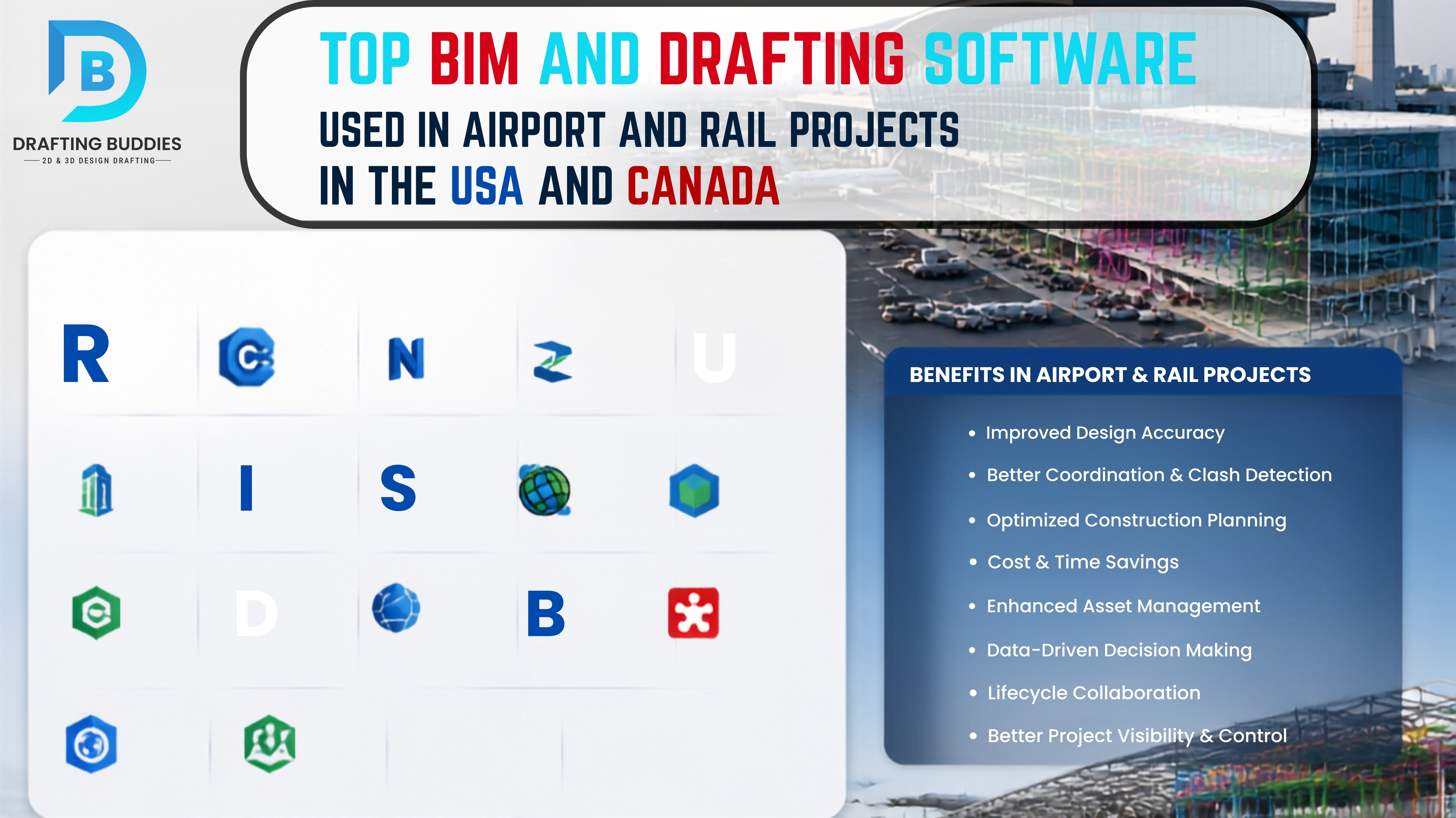
The Top BIM and Drafting Software Used in USA and Canada Airport & Rail Projects
1. Autodesk Revit The Industry Foundation for Building-Side BIM
Primary Use: Terminal buildings, stations, concourses, maintenance facilities, control towers
Key Features:
- Parametric 3D modeling for architectural, structural, and MEP systems
- Real-time collaboration across disciplines using Revit worksharing and Autodesk Docs
- Automated quantity takeoffs, schedules, and sheet creation
- Integration with Navisworks for clash detection
- Link to Civil 3D for civil-building coordination
Real-World Application LAX Expansion: During the $1.6 billion Tom Bradley International Terminal expansion and subsequent LAMP program at Los Angeles International Airport, the project team used Autodesk Revit and Navisworks as core modeling tools. Airport officials were able to use VR headsets connected to Revit and Navisworks to virtually walk through the new ramp control tower, checking visual clearance of airplane tails from the tower before a single piece of steel was erected. This capability to preview critical safety sightlines in a virtual environment is a defining advantage of BIM over traditional drafting.
Why It Matters Long-Term: Revit models created during design and construction can be handed over as as-built BIM models for facilities to airport or transit authority facility teams. Maintenance staff can query any wall, pipe, or electrical panel in the model to pull up its spec sheet, warranty, installation date, or maintenance history, making decades of facility management dramatically more efficient.
2. Autodesk Civil 3D: The Civil Engineering Backbone for Rail Corridors
Primary Use: Track alignment, grading, drainage, site civil work, utility coordination
Key Features:
- Intelligent corridor modeling for rail and transit alignments
- Automated earthwork volume calculations
- Pipe network design for drainage and utilities
- Data integration with Navisworks for federated model review
- Point cloud import for existing conditions surveys
Real-World Application LAX LAMP Rail Alignment: At LAX, utility data was exported directly into Autodesk Civil 3D and Navisworks and converted into a 3D model for the two-mile elevated rail alignment of the LAMP project. This 3D utility model was critical to avoiding underground utilities during foundation design. It helped contractors understand the complexity of what lay below grade and reduced construction risk substantially. The model was used for design reviews, utility coordination, and ongoing BIM coordination throughout construction.
Real-World Application Denver Eagle P3: The Denver Eagle P3 commuter rail project which added the East Corridor to Denver International Airport and the Gold Line used BIM-based digital modeling to coordinate rail network expansion. Civil 3D tools supported infrastructure integration across multiple construction packages, enabling real-time collaboration between design and construction teams working on different corridor segments simultaneously.
Why It Matters Long-Term: Civil 3D corridor models remain valuable for future maintenance planning, track renewal programming, and expansion feasibility studies. A transit authority with an intelligent corridor model can quickly assess the impact of adding a new station, grade-separating a crossing, or upgrading electrification without starting from scratch.
3. Autodesk Navisworks The Clash Detection and Coordination Engine
Primary Use: Multi-discipline model federation, clash detection, 4D construction simulation, project review
Key Features:
- Aggregates models from Revit, Civil 3D, Bentley, and other platforms into one federated view
- Hard clash, soft clash, and clearance clash detection across all disciplines
- 4D simulation linking model elements to construction schedules (with TimeLiner)
- Clash reports with assigned responsibility and resolution tracking
- Walk-through and section box tools for design review
Available Versions:
- Navisworks Manage - Full clash detection and project review
- Navisworks Simulate - Workflow management and 4D simulation without clash detection
- Navisworks Freedom - Free viewer for stakeholder review
Real-World Application - O'Hare Expansion: Airport expansion programs at Chicago O'Hare International Airport have used BIM workflows to coordinate large-scale construction across active terminal operations. Navisworks clash detection enables teams to identify conflicts between new structural elements, existing MEP systems, and active airside operations before work begins a critical capability when you cannot shut down a runway to resolve a coordination problem.
Why It Matters Long-Term: Every clash detected in Navisworks before construction saves an average of 10 to 20 times the cost of resolving the same issue in the field. For a $5 billion airport program, this translates to hundreds of millions in avoided rework. The clash logs and model coordination records also become part of the project's permanent as-built documentation.
4. Bentley OpenRail Designer - The Dedicated Rail BIM Platform
Primary Use: Track alignment design, rail corridor BIM, signal design, overhead line electrification (OLE), station design
Key Features:
- Constraint-driven 3D rail track design with real-time visualization
- IFC export for open BIM workflows and interoperability
- Integration with Bentley ProjectWise for collaborative data management
- Overhead Line Equipment (OLE) parametric component libraries for electrification design
- Point cloud, GIS, and reality mesh integration for real-world context
- 3D QA tools to virtually drive the corridor and inspect for alignment deficiencies
- Supports BIM Level 2 and beyond
Real-World Application Commuter Rail Projects: OpenRail Designer is the dominant platform for dedicated rail infrastructure design in North America and internationally. For projects involving metro, light rail, commuter rail, and high-speed rail, it provides a single application that handles track geometry, drainage, signals, structures, and electrification within one coordinated environment. Its ability to export IFC files ensures that models can be shared with any discipline or contractor regardless of their software platform, a critical requirement on multi-prime transportation contracts.
Canadian Application: In British Columbia, modernization work on the SkyTrain network and associated infrastructure has involved Bentley tools as part of digital delivery strategies aligned with broader smart city and digital twin objectives. The Canada Line has leveraged digital twin technology built on BIM foundations to optimize asset management and maintenance using real-time data.
Why It Matters Long-Term: OpenRail's ability to support digital twin authoring means that the model created during design does not become obsolete after construction. It evolves into an operational tool that can integrate IoT sensor data, track geometry monitoring, and predictive maintenance algorithms extending the useful life of the infrastructure model for decades.
5. Bentley MicroStation and OpenBuildings Designer Large Infrastructure Station Design
Primary Use: Complex infrastructure stations, intermodal hubs, mixed-use transit-oriented development
Key Features:
- Precision 3D modeling for large, complex infrastructure components
- Integration with OpenRail and OpenBridge for multi-discipline coordination
- Support for DGN, DWG, IFC, and multiple other formats
- Powerful reference file system for federated model management
- Used by major rail and transit agencies for capital delivery programs
Why It Matters Long-Term: Bentley's ecosystem ProjectWise for data management, AssetWise for operations creates a continuous digital thread from design through construction into facility management. Transit agencies that implement this full stack have a single authoritative data environment supporting maintenance crews, capital planning teams, and engineering staff for the life of the asset.
6. Autodesk InfraWorks Conceptual Planning and Corridor Visualization
Primary Use: Early-stage planning, route comparison, stakeholder visualization, GIS-integrated corridor studies
Key Features:
- Import real-world GIS data, terrain, aerial imagery, and point clouds to create realistic 3D planning contexts
- Quickly generate multiple corridor alternatives for comparative analysis
- Visualize proposed rail or airport access routes within actual urban environments
- Communicate design intent to non-technical stakeholders and regulatory agencies
Real-World Application: For new airport rail connections and intermodal access studies such as evaluating route options for connecting a downtown transit hub to an airport, InfraWorks allows planners to demonstrate alternatives to city officials and the public with photorealistic 3D visualizations for stakeholders, accelerating public approval processes.
Why It Matters Long-Term: Decisions made in the planning phase have the greatest cost leverage of any project stage. InfraWorks helps agencies make those decisions with real-world data rather than abstract 2D diagrams, reducing the risk of choosing a route that creates costly complications in later design phases.
7. Synchro 4D Construction Sequencing and Schedule Simulation
Primary Use: 4D BIM scheduling, phasing simulation, construction logistics planning
Key Features:
- Links Revit, Civil 3D, and other BIM models to project schedules (Primavera P6, MS Project)
- Animates the construction sequence in 4D to identify schedule conflicts and logistics constraints
- Supports live airport and rail environment construction planning, where phasing is critical
- Used for stakeholder communication and contract documentation
Real-World Application: For airport projects where construction must happen in phases around active aircraft operations, Synchro 4D is invaluable. Teams can simulate the construction of a new terminal pier while the adjacent concourse remains in full operation, identifying crane swing radii, temporary fence locations, and safety exclusion zones before work begins, rather than discovering conflicts on the job site.
8. Esri ArcGIS + BIM Integration: GIS-BIM for Airport Campus Management
Primary Use: Airport campus management, infrastructure asset inventory, spatial analysis
Real-World Application: Pittsburgh International Airport has adopted BIM as a design standard and integrated GIS-BIM workflows across its 8,800-acre campus. The construction of its new terminal, which opened in fall 2025, integrated BIM data into ArcGIS Pro and shared results through 3D Scene Viewer. This GIS-BIM integration has driven the airport's widespread adoption of GIS as a critical long-term management tool, allowing facility teams to manage infrastructure assets spatially across the entire campus.
Why It Matters Long-Term: Airports are effectively small cities. Managing runways, taxiways, terminals, utilities, landside roads, parking structures, and airfield lighting across hundreds or thousands of acres requires geospatial intelligence. GIS-BIM integration gives facility managers a spatially accurate, data-rich view of every asset on campus.
How BIM and CAD/Drafting Technology Work Together
A common misconception is that BIM has replaced traditional CAD drafting. In reality, they are complementary. Here is how they work together on a major airport or rail project:
| Stage | BIM Role | CAD/Drafting Role |
|---|---|---|
| Planning | InfraWorks corridor studies | Survey-based drawings |
| Conceptual Design | OpenRail ConceptStation alternatives | 2D schematic drawings |
| Detailed Design | Revit, Civil 3D, OpenRail models | Extracted 2D plan/section sheets |
| Coordination | Navisworks clash detection | RFI drawings, shop drawings |
| Construction | 4D Synchro simulation | Site instruction drawings |
| As-Built | Updated BIM model | Redlined record drawings |
| Operations | Digital twin, GIS-BIM | 2D facility drawings for trades |
The BIM model drives the intelligence; CAD drafting extracts human-readable deliverables, the construction documents, the permit drawings, and construction documents, and the shop fabrication details that contractors and trades use in the field.
BIM's Long-Term Value: The Lifecycle Advantage
This is where BIM truly differentiates itself from traditional drafting in a way that justifies every dollar of implementation investment.
Operations and Maintenance
Post-construction, a BIM model becomes a facility management asset. Studies by the National Institute of Building Sciences (NIBS) indicate that integrating BIM with operations can reduce facility lifecycle costs by up to 30%. For an airport terminal that will operate for 50 years, a 30% reduction in lifecycle cost represents a staggering return.
Maintenance staff using a BIM-linked facility management system can:
- Identify the exact location of any mechanical system, pipe, or cable tray behind a wall
- Pull up the full specification, warranty, and maintenance history of any asset
- Schedule preventive maintenance based on equipment age and usage data
- Plan infrastructure renewals with accurate quantity and spatial data
Digital Twins The Highest Form of BIM for Long-Term Management
A digital twin is a BIM model that is continuously updated with real-world operational data via IoT sensors. For airports and rail systems, this means:
- Real-time monitoring of HVAC, escalators, lifts, baggage systems, and power distribution
- Predictive maintenance alerts before equipment failure causes passenger disruption
- Energy consumption dashboards that identify inefficiencies in real time
- Simulation of emergency evacuation scenarios using real passenger flow data
On the Canada Line in Vancouver, a digital twin has been developed specifically to optimize asset management and maintenance using real-time data, enabling operators to visualize, monitor, and predict maintenance needs for track and infrastructure assets a model that other transit agencies across North America are actively studying.
At LAX, BIM and digital twin technology together provide continuous monitoring, analysis, and optimization of airport operations, with IoT data connecting to the underlying BIM model to enable predictive maintenance across the terminal campus.
Cost Certainty and Risk Reduction
BIM-enabled 5D cost management links model elements directly to unit rate libraries, allowing cost managers to generate accurate cost estimates directly from the design model. When scope changes, the cost estimate updates automatically. For a $10 billion airport modernization program, this level of cost transparency is transformative.
Regulatory Compliance and Handover
Federal Aviation Administration (FAA) capital improvement programs, Transport Canada infrastructure grants, and USACE (US Army Corps of Engineers) contracts increasingly require BIM deliverables as a condition of funding. Transit agencies, including the Port Authority of New York and New Jersey, have adopted BIM standards that contractors must comply with.
BIM models delivered at project completion provide a compliant, data-rich record of every design and construction decision, invaluable when regulatory audits, insurance claims, or future expansion planning require documentation from the original build.
Canadian Perspective: BIM Adoption in Transportation Infrastructure
Canada's transportation infrastructure sector has been moving rapidly toward BIM adoption, with several notable programs:
SkyTrain Network (Metro Vancouver): BC Rapid Transit Company has integrated BIM into capital delivery for SkyTrain expansions, with digital twin development for the Canada Line supporting operations and maintenance optimization.
Toronto Pearson International Airport: As one of North America's busiest airports, Pearson has used BIM for terminal expansions and its intermodal connectivity programs and rail links, including the Union Pearson Express rail link. The Greater Toronto Airports Authority (GTAA) has positioned digital delivery as a core part of its capital program strategy.
Alberta Infrastructure Projects: In Alberta, where extreme weather and large distances pose operational challenges, digital twins built on BIM foundations represent a significant opportunity to monitor road and rail asset conditions, anticipate deterioration, and optimize maintenance operations across remote corridors and infrastructure networks.
National Standards: Infrastructure Canada and provincial transportation ministries are progressively aligning with ISO 19650 BIM standards, bringing Canadian public-sector infrastructure delivery in line with international best practice.
Choosing the Right BIM Software Stack: A Practical Framework
For a transportation authority, design firm, or contractor evaluating BIM software, the decision comes down to three variables:
1. Asset Type
- Predominantly building infrastructure (terminals, stations) -> Autodesk Revit-led workflow
- Predominantly civil and rail infrastructure (tracks, earthworks, drainage) -> Civil 3D or OpenRail-led workflow
- Integrated rail+building (intermodal stations) -> Federated workflow combining both
2. Collaboration Requirements
- Large multi-prime delivery programs -> Bentley ProjectWise or Autodesk Construction Cloud (ACC) for data management
- Open BIM requirements (IFC exchange) -> Bentley OpenRail or Revit with IFC export
- Cloud-first collaboration -> Autodesk Docs / BIM 360
3. Lifecycle Stage
- Planning and concept -> InfraWorks, OpenRail ConceptStation
- Detailed design -> Revit + Civil 3D or OpenRail Designer
- Coordination -> Navisworks, Revizto
- 4D scheduling -> Synchro 4D
- Operations -> GIS-BIM (ArcGIS), Digital Twin platforms, AssetWise
Conclusion: BIM Is Infrastructure's Most Valuable Long-Term Investment
The top BIM software tools used in airport and rail projects across the USA and Canada, Autodesk Revit, Civil 3D, Navisworks, Bentley OpenRail Designer, InfraWorks, Synchro 4D, and GIS-BIM platforms, are not just construction tools. They are lifecycle management systems that begin delivering value at the first design session and continue delivering value for decades after the ribbon is cut.
At LAX, BIM and AR/VR technology helped a $1.6 billion expansion team stay on budget and schedule while managing active airport operations. At Pittsburgh International Airport, GIS-BIM integration is enabling smarter campus management across an 8,800-acre facility. On Vancouver's Canada Line, a digital twin is already optimizing maintenance and predicting asset needs in real time. In Denver, BIM coordination brought a complex P3 rail network expansion to life with unprecedented precision.
The message is consistent: transportation agencies and design firms that invest in BIM not just as a drawing tool, but as a full lifecycle data strategy are building infrastructure that is safer, cheaper to maintain, and more adaptable to the demands of the next century.
For professionals in the AEC sector, mastering this software stack is no longer optional. It is the language of modern infrastructure delivery today.
Recent Blogs
FAQs:
You Ask, We Draft